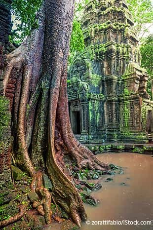
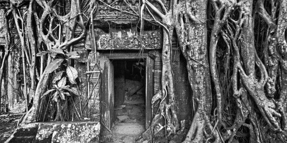
Gigantic stone towers stand high above the thick Cambodian forest, looking like ancient rocket shipRaumschiff (mit Raketenantrieb)rocket ships. Tree-root tentacles creep around doorways and over the stone faces of smiling god kings, who seem unaware that their empire has long been taken over by the natural world.
When you explore the mysterious temples of Angkor — as do two million other tourists who come here each year — it can still feel like you’re uncovering this lost kingdom for the first time. What’s harder to imagine, as you walk among the ruined monuments in the middle of the jungle, is that they were once part of the largest city on the planet.
For years, archaeologists had guessed that this might be true, but it was only recently confirmed in astonishing detail by lasers used in an aerial survey(Land-)Vermessungsurvey. The lasers cut through the trees for the first time a few years ago to to revealetw. enthüllenreveal the gridGitternetz; Rastergrid of a huge urban settlement stretching for kilometres around the temples. It showed that the ancient Khmer capital, which flowered between the 9th and the 15th centuries, had much more in common with Los Angeles than this series of temples standing in splendid isolation in the jungle had led us to believe.
“The laser technology has been a total to be a game changerbahnbrechend sein; hier: neue Erkenntnisse bringengame changer,” says Damian Evans, the Australian archaeologist who has been leading the scanning survey at the École Française d’Extrême-Orient, working with the Cambodian APSARA National Authority and the Ministry of Culture and Fine Artsschöne KünsteFine Arts. “Our surveys have revealed a settlement comparable in size to LA or Sydney, with an urban form that resembles the kind of megacity characteristic of the modern world.”
The laser technology has been a total game changer. Our surveys have revealed a settlement comparable in size to LA or Sydney
For centuries, explorations of Angkor focused on the temples and their religious symbolism — and it’s not hard to see why.
“Grander than anything left to us by Greece or Rome” was the judgement of young French explorer Henri Mouhot when he discovered Angkor in 1858. He described the complex as “a rival to [the temple] of Solomon”. The central Angkor temple, built by King Suryavarman II in the early 12th century, remains the largest religious complex in the world — four times larger than Vatican City, with its five conical towers rising above a 160-hectare area.
Larger than modern-day Paris
As these were the only surviving structures in the area, it was assumed that the temples must have operated like ancient walled towns, perhaps built by successive kings, and each inhabited by staff of a few thousand people. It was thought that the royal families moved from one complex to the next, which would explain the separate settlements spread across the plain.
The reality, it turns out, was nothing of the sort. In 2012 and 2015, laser surveys revealed that these walled areas didn’t contain much at all. They were instead surrounded by a to sprawlAusdehnung; sich ausdehnensprawling urban network — a grid of boulevards, streets and canals that extended far into the surrounding landscape, covering an area larger than modern-day Paris.

What archaeologists had been studying for generations was simply the equivalent of a European city with everything destroyed except for the churches and cathedrals. At its peak in the 12th century, when London had a population of 18,000, Angkor was home to hundreds of thousands, some estimate up to three quarters of a million people. So what form did this megacity in the rice fields take?
Discovered after a helicopter flight
Evans says he doesn’t like to use the word “city” to describe Angkor because it doesn’t follow the usual pattern of an ancient walled city with a clearly defined edge. Instead, the lasers uncovered a very denselydichtdensely populated downtown urban centre, covering an area of 35 to 40 square kilometres.
This gradually gives way to a kind of agro-urban outer area that leads into a world of neighbourhoodhier: (in der) Umgebungneighbourhood shrineHeiligtumshrines, mixed up with rice fields, market gardens and pondTeichponds. “It was the prototype of a modern-day suburban sprawl,” he says. Thanks to technology developed by NASA, all of this was discovered after a few hours of helicopter flight, as opposed to generations of hacking through the jungle by hand (while keeping a lookout for landmines). Shooting a million laser beams every four seconds from the bottom of a helicopter, the technology, called lidar (“light imaging detection and rangingetwa: Darstellung und Entfernungsmessung mittels Laserstrahlenlight imaging detection and ranging”), creates a kind of virtual deforestationEntwaldungdeforestation, revealing what lies beneath the trees on the forest floor.
The scanning to expose sth.etw. enthüllen, ans Licht bringenexposed the “bones” of the city, says Evans. “On the ground you just see bumpBeule; hier: Unebenheitbumps, but this aerial view shows a highly developed system of road networks, planned neighbourhoods and intricate waterworksWasser-versorgungssystemwaterworks. Angkor was a work of geoengineering on an unparalleled scaleAusmaßscale.”
Any signs of these neighbourhoods on the ground have long sinceseit langemlong since disappeared. In Khmer society, stone was reserved exclusively for religious monuments. Everything else — even the royal palaces — was made of wood with grass roofs. And homes were built on stiltStelze, Pfahlstilts on top of earthen moundHügelmounds to keep them above the floodwaters in the rainy season.
The Khmer’s masteryKontrollemastery over the natural landscape was perhaps their greatest achievement. The lidar mappingKartierungmapping has exposed complex levels of terraformingTerraforming; hier: Umgestaltung des Lebensraumesterraforming and water-management systems that were way ahead of any other settlement of the era.
Once again, earlier archaeological studies focused on the symbolic role of water in Angkor’s cosmological order, reading the vast reservoirStauseereservoirs as symbols of the mythological oceans surrounding Mount Meru, home of the Hindu gods. While the waterworks clearly played a part in the sacredheilig, ehrwürdigsacred geography of the city, they were fundamentally there to to irrigate sth.etw. bewässernirrigate the rice fields, the source of the empire’s great wealth. Success in a tropical climate ultimately depended on the ability to control flooding during the summer monsoonMonsunmonsoon and store enough water to irrigate the fields during the dry seasonTrockenzeitdry season.
Finding reasons for Angkor’s declineNiedergangdecline
Residential neighbourhoods were arranged around thousands of communal rainfall ponds, while the fields were irrigated by a pair of great reservoirs, or barays, the whole system connected by an extensive network of canals. The West Baray, which stretches five miles by one mile to the west of downtown Angkor, remains the largest hand-cut body of waterGewässerbody of water on earth. But this hydrological masterpiece, Evans and his team now believe, might also have led to Angkor’s decline.
Archaeologists have long speculated on why the Khmer capital fell into ruin
Archaeologists have long speculated on why the Khmer capital fell into ruin. One theory is that a Siamese invasion in 1431 caused the kings and their people to flee to an area near present-day Phnom Penh. But there is little evidence in the settlements of a mass migration.
Others argue that, when the more peaceful Buddhism replaced Hinduism in the early 13th century, it ended the Khmer Empire’s desire for wars — and monument building. Yet this ignores the violent expansions of other Buddhist rulers in the world at the time. Another weaker theory is that the Khmer to exhaust oneselfsich überfordernexhausted themselves with their building projects.
Forgotten, but never a lost city
Evans, however, now believes that environmental factors played a significant part. “Looking at the sedimentarySediment-,Ablagerungs-sedimentary records, there is evidence of catastrophic flooding,” he says. In the expansion of Angkor, all of the forests in the watershedWasserscheide; hier: Wassereinzugsgebietwatershed were destroyed. The survey found signs of failures in the water system, revealing that various parts of the network simply broke down. With the entire feudal society depending on the successful management of water, a break in the chain could have been enough to begin the decline.
While it might be temptingverlockendtempting to imagine a colourful mass exodus, Evans believes there was no dramatic collapse at all. “There is a lot of evidence for continued vitality in Angkor,” he says. When Portuguese traders visited in the 16th century and French explorers came in the 19th century, they found communities of several thousand people living in and around the temples. “It might have disappeared from the consciousness of Europeans for a time,” he adds, “but Angkor was never a ‘lost city’.” It just got a bit overgrown.
© Guardian News & Media 2016
Neugierig auf mehr?
Dann nutzen Sie die Möglichkeit und stellen Sie sich Ihr optimales Abo ganz nach Ihren Wünschen zusammen.


